


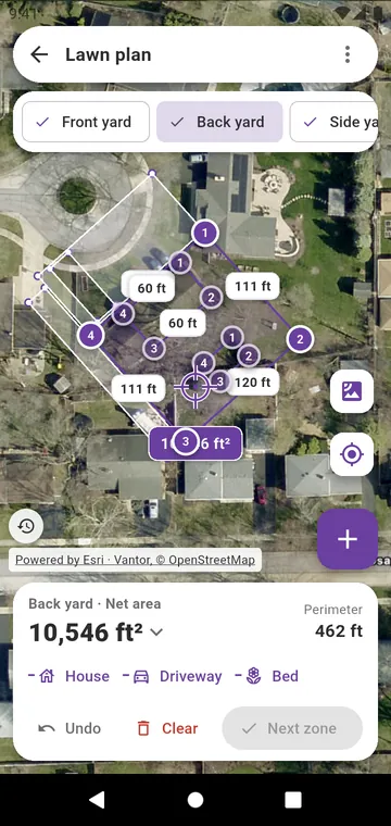
Trace each zone
Tap each corner of a zone on the satellite photo: front yard, back yard, side yard. Next zone starts the next one. Draw the house, the driveway and the flower beds inside a zone: House, Driveway and Bed come out of its area. The total for the whole lawn is shown in square feet or acres, or in square meters.
Other ways to get a size
- Type a zone's area, in the menu of My lawn, when you already know it.
- Walk the edge (GPS), in the menu of the lawn plan, when the edge is hidden under trees.
- Saved drawings brings back a lawn you drew before.
The photo under the drawing
The date of the satellite photo is shown; switch to an older year when trees hide the edge. A drawing is as good as the photo under it: right for buying bags, not a property survey.